District 20 · Bishan · Location Guide
Lorong Puntong Condo location: 450 metres from a future interchange
A short lane off Sin Ming Avenue, in the part of Bishan where Thomson’s landed streets meet the HDB heartland, five to six minutes on foot from Bright Hill MRT, and a direct Thomson-East Coast Line ride to Orchard and Shenton Way.
Where the site actually sits
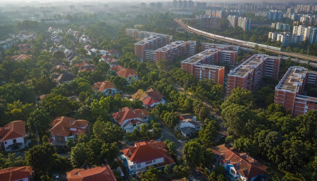
Lorong Puntong is a quiet side lane running off Sin Ming Avenue, inside District 20 and the Bishan planning area. The 46,103 sqft plot fronts the junction with Bright Hill Drive: Thomson Impressions, completed in 2019, stands immediately next door, and Ai Tong School fills the opposite side of the road. To the west, the terrace houses of Thomson Rise and Windsor Park; to the east, Bishan’s HDB blocks and the Sin Ming light-industrial belt.
It is a mature estate in every sense that matters to a buyer: schools, coffee shops and bus routes already in place, yet it has seen no new Government Land Sale residential plot since 2015. That eleven-year gap is a large part of why seven bidders chased this tender, and why the winning land rate set a record for the Rest of Central Region.
Bright Hill MRT: the honest walking maths
Bright Hill station (TE7) opened with the Thomson-East Coast Line’s third stage and sits about 400–500 metres from the site, five to six minutes at an ordinary walking pace. Be sceptical of any advertisement that quotes a single precise number. The actual walk depends on which station exit opens nearest the development’s gate, and one property analyst has cautioned that the route can stretch past ten minutes from certain entry points. We would rather you time it yourself from the published site plan than inherit a flattering figure.
What the line already delivers is not in doubt. From Bright Hill, the TEL runs south through Upper Thomson, Stevens and Orchard (about twenty minutes to Orchard Road) and continues direct to Shenton Way and Gardens by the Bay without a change of train. Northbound, it connects to Woodlands and the causeway corridor.
2030: the Cross Island Line arrives
Bright Hill becomes a full interchange (CR13 on the Cross Island Line) when CRL Phase 1 opens in 2030. Phase 1 runs 29 kilometres from Aviation Park in the east to Bright Hill, with twelve stations and interchanges at Pasir Ris (East-West Line), Hougang (North East Line), Ang Mo Kio (North-South Line) and Bright Hill itself. Construction began in January 2023; Phase 2 towards Jurong Lake District and the Punggol Extension follow around 2032.
For residents of Lorong Puntong Condo, the practical effect is a second rail spine through the estate: direct trains to Loyang, Tampines North, Defu, Serangoon North and Teck Ghee, and one-change access to almost every major line on the network. Note the sequencing, too: the development’s estimated TOP of 2031–2032 lands after the interchange opens, so buyers are not paying today for a station that arrives only at the end of their lease.
| Destination | Line | Approx. time |
|---|---|---|
| Upper Thomson (Thomson Plaza) | TEL | 2 min · 1 stop |
| Orchard | TEL | ~20 min · direct |
| Shenton Way (CBD) | TEL | ~30 min · direct |
| Gardens by the Bay | TEL | ~35 min · direct |
| Ang Mo Kio | CRL (from 2030) | ~6 min · 2 stops |
| Tampines North | CRL (from 2030) | ~25 min · direct |
| Aviation Park / Loyang | CRL (from 2030) | ~40 min · direct |
Journey times are indicative estimates from published line maps; CRL timings assume Phase 1 opening in 2030.
Driving: PIE and CTE within minutes
Sin Ming Avenue feeds directly onto Thomson Road, which gives drivers two fast options: south into town via Lornie Road to the PIE, or east along Braddell Road to the CTE. Off-peak, Orchard Road is roughly a fifteen-minute drive and Shenton Way about twenty. Neither expressway requires a long crawl through estate roads first, a small mercy that residents of deeper landed enclaves will appreciate.
Parking ratios and the exact vehicular entrance will be confirmed with the approved plans. Given the 140-unit scale, expect a single access point onto Lorong Puntong rather than Sin Ming Avenue proper.
An estate in the middle of a slow transformation
Sin Ming has spent decades as a working district: autocare workshops, light-industrial terraces, the Midview City office-and-lifestyle block. That character is now shifting. Artisan 8, a 34-unit freehold project on Sin Ming Road, launched in August 2025 and averaged S$2,388 psf; this GLS tender drew seven bidders at a record rate. Plot by plot, the industrial edge is giving way to homes, while the park connector along the Kallang River ties the neighbourhood into Bishan-Ang Mo Kio Park, and Windsor Nature Park, MacRitchie and Lower Peirce sit within a kilometre or two to the north and west.
Transformation cuts both ways: some workshops will remain neighbours for years, and construction around a CRL station brings periodic disruption. We would call the area improving rather than polished, and price expectations should reflect that honesty. For the food and greenery side of the ledger, see our amenities guide.
Location questions, answered
How far is Lorong Puntong Condo from Bright Hill MRT?
Roughly 400–500 metres, about a five-to-six-minute walk for most adults. Estimates vary by which station exit and gate you use; one analyst has suggested the walk can stretch past ten minutes from certain exits, so time the exact route from the showflat map when it is published.
When does Bright Hill become an MRT interchange?
In 2030, when Cross Island Line Phase 1 opens: 29 km from Aviation Park to Bright Hill with twelve stations and interchanges at Pasir Ris, Hougang, Ang Mo Kio and Bright Hill (CR13/TE7). Phase 2 and the Punggol Extension follow around 2032.
Is the site near a columbarium?
Yes. Bright Hill Columbarium stands about 550 metres from the site, near the Kong Meng San temple cluster on Bright Hill Drive. We flag it so you can factor it into your decision, not discover it later.
Which expressways serve the area?
The PIE via Thomson and Lornie Roads, and the CTE via Braddell Road. Off-peak, Orchard is roughly a 15-minute drive and the Shenton Way financial district about 20 minutes; peak-hour journeys take considerably longer.
Sources: LTA: Cross Island Line · LTA: Thomson-East Coast Line
Walk the route before the crowd does.
Registrants receive the measured site map, station-exit walking routes and stack-orientation notes as soon as the developer publishes them, plus priority showflat slots. No obligation, no spam.